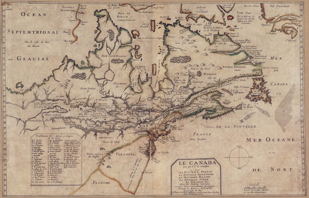
| This map (1653) shows the limits of
French knowledge about North America in the middle of the 17th century.
Du Val, the King's Geographer, lists New France, New England, New
Holland, New Sweden and Virginia as the major areas he has indicated.
Notice the importance given to the St. Lawrence and the future Great Lakes, as well as the native tribes involved in the fur trade and the interpretation given to the "frozen ocean". |
|
|